
Tracing a Jefferson County Street Directory Address
Begin with the address as a record key, not a person's name. Jefferson County streets can cross incorporated cities, unincorporated pockets, special districts, and postal areas. Write down the house number, directional, street name, street type, and unit exactly as supplied. The county Master Address layer or jMap can help normalize the string and show which county or municipal custodian is likely to hold the next record.
That check separates an owner label from a resident clue. An assessor card identifies an account and history, a deed records an instrument, voter data is dated, and a historical directory is a publication snapshot. No single field proves who occupies an address.
- Normalize the address. Run it through Master Address or jMap. Confirm street type, postal label, parcel context, and jurisdiction.
- Find the parcel and owner label. Use Assessor Address mode. Save property address, PIN, AIN, TAG, owner, class, and mailing address, keeping situs and mailing fields apart.
- Walk the deed chain. Bridge the assessor document number, PIN, AIN, or legal description to the recorder. Read the PDF and search the prior link.
- Check dated voter data. Use the county or state request route for permitted fields. Confidential voters are excluded, and registration is not occupancy.
- Reach the historical street shelf. Ask DPL Western History or JCPL for a reverse volume by municipality and year. Cite the edition and compare it with a parcel or deed.
A street directory is strongest when the chain stays narrow: one address, parcel, date range, and record type. A blank result may reflect spelling, jurisdiction, a series cutoff, privacy, or missing digitization.
Jefferson County Assessor Address Fields
The Jefferson County Assessor address search exposes the fields that shape a street query. Address Number, pre-directional, street name, and unit are optional in the captured form. Street Type, City, and Postal Code carry required marks. The dropdown vocabulary is a search aid, not a boundary map.
Keep the displayed spelling and street type. The city menu includes Arvada, Golden, Lakewood, Morrison, Evergreen, Wheat Ridge, and values beyond a county-only list. The postal menu also has neighboring or legacy-looking values. Verify an uncertain label through USPS, then compare the physical address, parcel, and legal city layer.
| Field | Type | Required mark | Use in a street search |
|---|---|---|---|
| Address Number | Text | Optional | House number; captured placeholder is 12345. |
| Pre-directional Type | Dropdown | Optional | E, N, NW, S, SE, SW, or W. |
| Street Name | Text | Optional | Keep the local spelling. |
| Street Type | Dropdown | Marked required | Choose the displayed type, such as ST, RD, AVE, CT, LN, or WAY. |
| Unit Number | Text | Optional | Use for an apartment or condominium address variation. |
| City | Dropdown | Marked required | Choose the portal value, not a legal city limit. |
| Postal Code | Dropdown | Marked required | Narrow the grid, then verify the address. |
The captured form uses model and debounce behavior. Help is visible, but no Search or Reset button appears. Results show Property Address, City, Postal Code, PIN, AIN, TAG, Owner, Property Class, and Mailing Address, with export and pagination. Help indicates a 20,000-record export cap, so keep the query focused.
An owner label maps to the assessment account, while a mailing address receives tax notices. Neither field establishes occupancy. Preserve the source date and use the parcel ID as the bridge onward.
The official address form makes the starting fields visible before a result is opened.
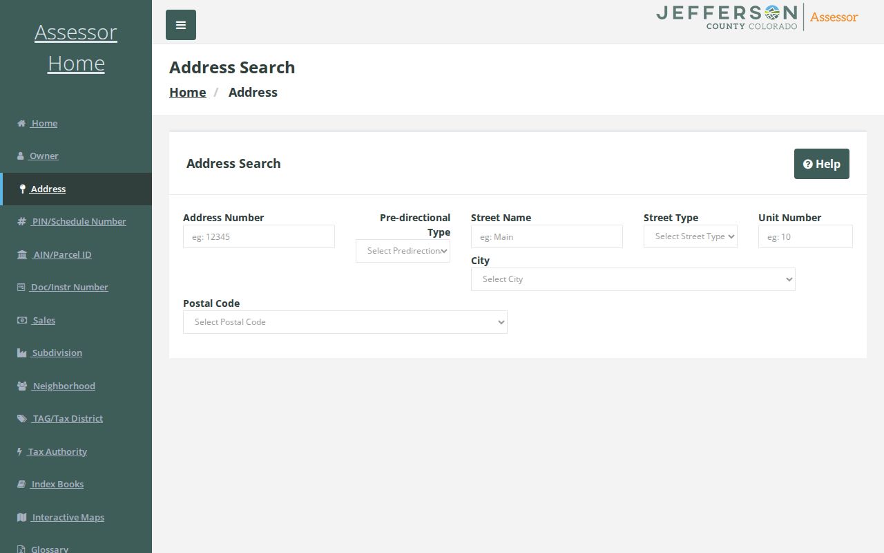
This assessor view belongs at the start of an address chain because it frames the parcel search without calling the result a household list.
Mapping Jefferson County Streets and Parcels
The county's GIS gallery, jMap, and ASPIN parcel maps answer different street questions. jMap searches by address number, parcel ID, street name, and reception number. Layers include property, zoning, the Comprehensive Master Plan, permits, taxes, and nearby development applications.
ASPIN selects parcels, prints maps, queries Parcel ID or Schedule Number, and links to assessor data. Select the subject polygon, note adjacent parcel IDs and addresses, then repeat the assessor search. The map supplies context. The legal description and recorded instrument control the legal chain.
The Jefferson County GIS entry point shows the map tools used to place an address in its street and parcel setting.
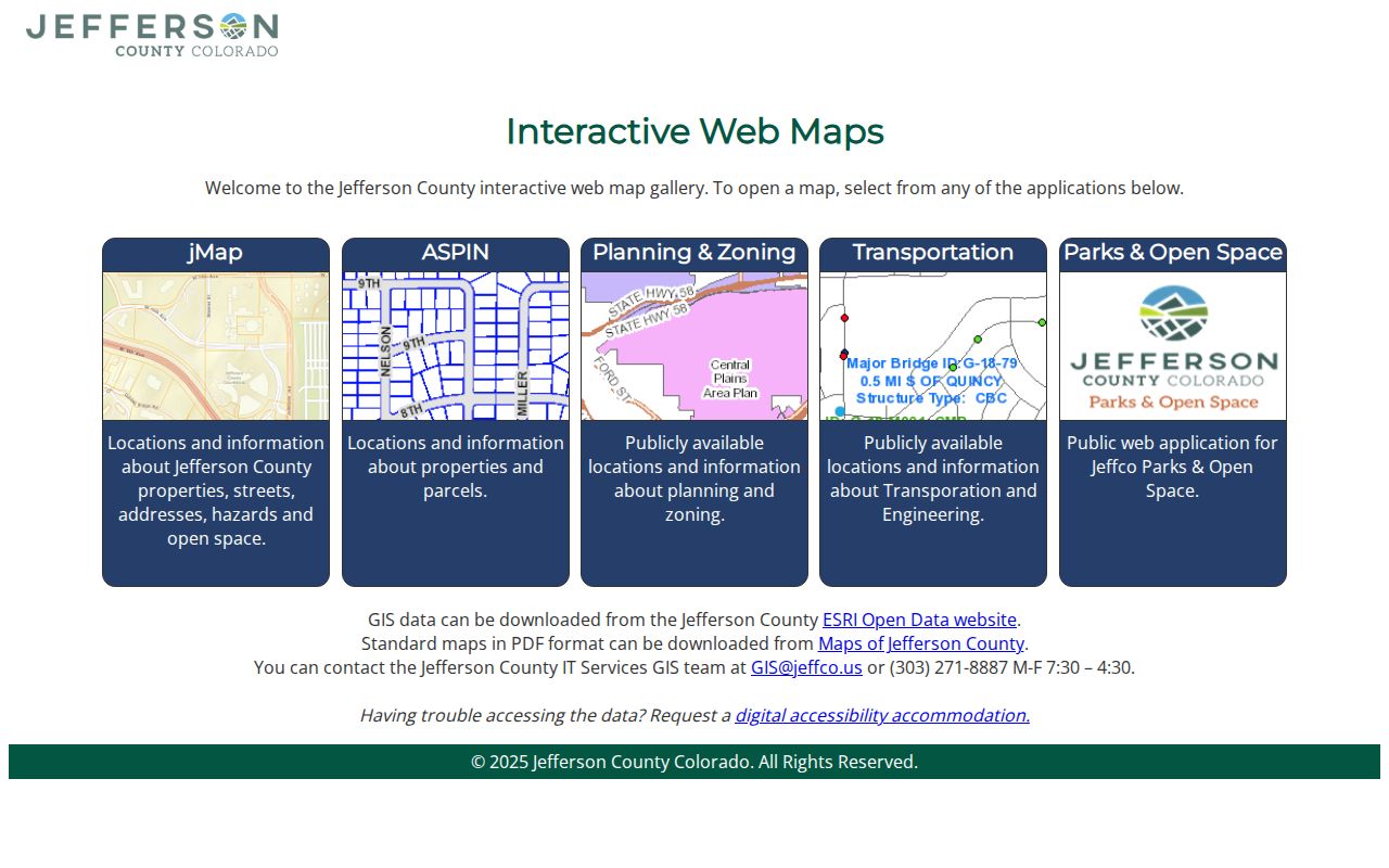
A GIS layer can show a neighboring parcel, city layer, or notification area, but a boundary line is not a survey and an HOA polygon is not a membership roster.
Jefferson County Street Directory Coverage
No single Jefferson County roll lists every person along a street. Each record set has a different keeper, field meaning, and access path. The assessor starts with a parcel account, GIS supplies geography, the recorder supplies instruments, permits add address activity, and historical directories preserve a dated publication.
Use the table as a routing map. The street directory question becomes more precise when the next search is chosen from the field that the last record actually provides.
| Record set | Keeper | Street-level question | Access |
|---|---|---|---|
| Master Address | County GIS | Does the county recognize the address and postal geometry? | REST/query and GIS; maintained layer. |
| Assessor parcel card | Jefferson Assessor | Which parcel, owner label, PIN/AIN, situs, mailing, class, and history match? | Free online; counter and phone fallback. |
| ASPIN and jMap | County GIS and Planning | Which parcel, adjacent parcel, jurisdiction, or layer touches it? | Free map and print; disclaimer. |
| Building permit | Building Safety | What permit activity is address-keyed? | Citizen Portal; older plans by CORA. |
| Deed, mortgage, lien, or plat | Clerk and Recorder | Which parties, descriptions, dates, and instruments connect? | Index/PDF; counter, copy, or CORA fallback. |
| Tax and assessment reports | Assessor, Treasurer, Archives | Which tax district, mill levy, abstract, or history applies? | Free reports; parcel questions route to the office. |
| Voter data | County or state custodian | Which dated residence, mailing, precinct, party, name, or history fields are permitted? | Request-controlled; confidential voters excluded. |
| Historical directory | DPL, LOC, or JCPL | Who was published at the address in a named edition? | Library/archive; edition and OCR caveats. |
Parcel IDs, document numbers, legal descriptions, edition dates, and citations are the handoffs. Keep the field meaning beside each copied name.
Postal Labels in Jefferson County Streets
Jefferson County's official ZIP coverage material warns that a primary town is a post-office city, not a legal municipal boundary. That matters on a street directory search. ZIP 80212 may use Denver as the postal city while serving Wheat Ridge, Mountain View, or Lakeside addresses. ZIP 80225 identifies the Denver Federal Center. ZIP 80127 and 80128 use Littleton labels in a county context.
Cross-county examples include 80020 with Broomfield and Jefferson, 80027 with Boulder and Jefferson, 80031 with Adams and Jefferson, 80135 with Douglas and Jefferson, 80162 with Arapahoe and Jefferson, 80235 with Jefferson and Denver context, and 80470 with Jefferson and Park. Use the physical address plus parcel or PIN to choose a custodian. USPS ZIP Code Lookup can verify one supplied address, but it does not identify residents.
Jefferson County Permits by Address
Jefferson Building Safety's online-services instructions point to the Citizen Portal. Start with Address Lookup, enter only the house number, select the full address, and submit. Public search is open without the project-account workflow; an account manages applications, documents, inspections, and licenses.
Permit records add context, not a resident verdict. The public page does not expose a full field schema, so view the result before promising owner, contractor, or inspection fields. Archived plans go through an open-records request. Building Safety is at 100 Jefferson County Parkway, Suite 3540, Golden, 303-271-8260, Monday through Thursday, 8 to 5. Lakewood and Arvada use their own city channels, so include the full situs address, parcel or PIN, date, and jurisdiction in a request.
Deeds Behind the Jefferson County Street Directory
The Jefferson County recorder portal separates control number, party name, book/page, reference, refers-to, instrument type, and marriage search modes. Party-name work should try grantor and grantee separately, add an instrument type and date, then inspect the PDF rather than the result-row name.
A street address is not always the recorder's main key. Bridge with the assessor PIN or AIN, document number, and legal description. Record the instrument, date, type, parties, book/page or reception reference, legal text, related instrument, return information, and image link. The forms and fees page gives current copy details.
- Identity: instrument, document, or control number and recording date.
- Parties: grantor and grantee names, with punctuation, initials, corporate, or trust forms preserved.
- Reference: book/page, reception number, PIN/AIN, and related instrument.
- Legal text: subdivision, lot, block, or metes-and-bounds description and return field.
- Image: the PDF link and any terms, redaction, or restricted-image notice.
Military discharge and other sensitive documents may have restricted images. Do not copy personal identifiers. The Recording Notification Service is a forward alert after registration, not a historical search or a validity guarantee.
Jefferson County Streets Across Time
Historical place labels can matter more than modern street fields. Golden City became Golden in 1872. A 1859 to 1874 directory may use Golden City, Golden, Golden Gate, a mining district, or a post office. Early boundaries also changed, and old deeds may use lot/block or metes and bounds instead of a house number.
No countywide street-renumbering log with dates was located. Resolve an old address by comparing the edition and spelling in the DPL Colorado Directories Index, the locality index of the LOC telephone reel, maps, plats, the assessor legal description, the address layer, a deed, and a newspaper.
The Master Address service is the current layer in that comparison.
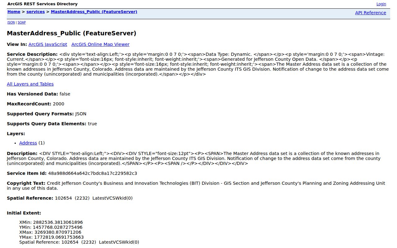
Its address geometry can help connect a current label to a parcel, but the historical deed, plat, and dated publication still carry the evidence for an older name.
Criss-Cross Leads for Jefferson County Streets
The research did not locate a named Jefferson County reverse or criss-cross title with a complete local run. Ask DPL Western History, JCPL HeritageQuest, or a local-history desk for a volume by municipality and year. Inspect its title page, publisher, locality, address section, and year before treating a hit as coverage.
The DPL index surfaces Jefferson County leads for 1932 and 1933, Golden leads from 1859 through 1952, Lakewood leads from 1916 through 1960, and Evergreen and Morrison leads from 1948 into the 1970s. Arvada microfilm and the 1969 to 1974 Greater Metropolitan Denver reels add dated snapshots. Collection details belong with the Jefferson County city directory collections.
Historical flow: address or street name, edition and municipality, address section, dated name snapshot, then parcel, deed, newspaper, or archive corroboration.
Jefferson County Street Search Fallbacks
Online access is only one channel. If a grid is too new, a portal times out, or an older record was never imaged, route the request to its custodian. Include the exact address, PIN, instrument, date range, and jurisdiction.
- Counter or terminal: use the Assessor counter, Clerk and Recorder research area, map room, or Archives appointment route.
- Phone: recording 303-271-8121, copies 303-271-8186, Clerk and Recorder 303-271-8168, assessor 303-271-8600, GIS 303-271-8887, Archives 303-271-8448.
- Written request: send a narrow CORA request with the record, date range, names, and identifiers.
- Library and archive: use JCPL databases and microfilm, DPL directories, Archives lists and maps, and museum holdings.
- Older context: check State Archives and FamilySearch where a county book is actually listed.
Court, sheriff, library, building, and municipal records route away from the Clerk and Recorder. The physical parcel and actual jurisdiction choose the custodian, not the postal city.
Jefferson County Street Records Terms
These terms keep a street directory result from being read as more than it says.
- Parcel
- A mapped piece of land with a county assessment account, PIN or AIN, and a record history.
- Situs address
- The physical location of the parcel or building. It is different from the mailing address used for notices.
- Plat
- A recorded map or subdivision drawing that can preserve lot, block, street, and parcel relationships.
- Legal description
- Recorded lot-and-block or metes-and-bounds text that often bridges an older deed better than a modern street label.
- Criss-cross directory
- A historical reference that may organize names by address or street, when a particular publisher and year actually contain that section.
Mailing address, postal city, owner label, and occupant are not interchangeable. Keep the field name beside each value.
Limits of a Jefferson County Street Directory
A street directory cannot show every household member or person connected to a parcel. The assessor identifies an account, a deed an instrument, a permit an activity, and voter data a dated registration field. Confidential voters are excluded. A historical directory captures only what its edition printed.
Do not publish an inferred occupant list from adjacent parcels, an HOA polygon, a mailing address, or a common surname. For family history, house history, seller verification, or civic curiosity, cite the source and date, keep the search narrow, and stop when the record does not support the conclusion.
Lawful use. Jefferson County address records are for lawful personal research. Do not use names, addresses, maps, or record links to stalk, harass, intimidate, or harm anyone.