
Jefferson County ZIP Coverage, Row by Row
The official Jefferson County Food System report dated June 24, 2024, Appendix A-3a-1, lists every ZIP identified within the county, including ZIPs primarily associated with another county. Its primary town is the post-office city, not a legal municipal boundary. The table keeps that distinction visible so a postal label does not send a records question to the wrong custodian.
| ZIP | Areas Covered | Post Office | Notes |
|---|---|---|---|
| 80001 | Arvada | Arvada | County table says stats unavailable; verify current postal assignment. |
| 80002 | Arvada | Arvada | Urban Arvada ZIP. |
| 80003 | Arvada | Arvada | Public assessor city and ZIP filters. |
| 80004 | Arvada | Arvada | Arvada. |
| 80005 | Arvada | Arvada | Arvada. |
| 80006 | Arvada | Arvada | Stats unavailable in the county table; use current USPS data. |
| 80007 | Arvada edge and foothill area | Arvada | Jefferson County table entry. |
| 80020 | Broomfield and Jefferson County | Broomfield | Primarily alternative county; do not route solely from ZIP. |
| 80021 | Westminster and Jefferson County | Westminster | Westminster postal city; county table includes Jefferson. |
| 80027 | Louisville and Jefferson County | Louisville | Primarily Boulder County; a Jefferson parcel can carry this ZIP. |
| 80031 | Westminster and Jefferson County | Westminster | Primarily an alternative county. |
| 80033 | Wheat Ridge | Wheat Ridge | Wheat Ridge. |
| 80034 | Wheat Ridge | Wheat Ridge | Stats unavailable in the county table. |
| 80123 | Littleton and Jefferson County | Littleton | Littleton postal city; county portion. |
| 80127 | Ken Caryl and southwest county context | Littleton | Assessor city filter can help narrow the county portion. |
| 80128 | Columbine and southwest county context | Littleton | Assessor city filter can help narrow the county portion. |
| 80135 | Sedalia and Jefferson County | Sedalia | Primarily Douglas County; small Jefferson portion. |
| 80162 | Littleton and Jefferson County | Littleton | Primarily Arapahoe County; verify municipal and county custodian. |
| 80212 | Lakeside, Denver, Wheat Ridge, and Mountain View | Lakeside or Denver | Postal city can say Denver while the address is in Jefferson County. |
| 80214 | Edgewater | Edgewater | Highest-density example in the county food report. |
| 80215 | Lakewood and Applewood | Lakewood | Jefferson County. |
| 80225 | Denver Federal Center | Denver Federal Center | Federal Center postal designation; not a simple city-limit label. |
| 80226 | Lakewood | Lakewood | Lakewood. |
| 80227 | Lakewood | Lakewood | Food report notes few food-access locations. |
| 80228 | Lakewood and foothill edge | Lakewood | Jefferson County. |
| 80232 | Lakewood | Lakewood | Lakewood. |
| 80235 | Lakewood, Jefferson County, and Denver County | Lakewood | Cross-county ZIP; verify jurisdiction with the physical address. |
| 80401 | Golden county-seat and urban core | Golden | Jefferson County. |
| 80402 | Golden | Golden | Stats unavailable in the county table. |
| 80403 | Golden and foothill postal area | Golden | Jefferson County. |
| 80419 | Golden | Golden | Stats unavailable; use current USPS verification. |
| 80425 | Buffalo Creek and mountain area | Buffalo Creek | Rural postal area in Jefferson County. |
| 80433 | Conifer and foothill corridor | Conifer | Jefferson County. |
| 80437 | Evergreen | Evergreen | Stats unavailable in the county table. |
| 80439 | Evergreen | Evergreen | Jefferson County. |
| 80453 | Idledale mountain community | Idledale | County report discusses travel outside the ZIP for services. |
| 80454 | Indian Hills mountain community | Indian Hills | No food-access or production points in the report; that is not evidence of no residents. |
| 80457 | Kittredge mountain community | Kittredge | County report marks no food-access or production points. |
| 80465 | Morrison | Morrison | Jefferson County. |
| 80470 | Pine, Jefferson County, and Park County | Pine | Crosses the county line; verify the physical jurisdiction. |
The county table is the location-specific coverage source. The assessor dropdown contains additional values because the property portal handles broader mailing and situs data. Use the USPS ZIP lookup for one address, then check parcel and county layers before choosing an office.
Postal Cities Do Not Set Jurisdiction
A ZIP code is a delivery construct, not a county or city line. Jefferson's eastern edge makes that plain. The official table lists 80212 with Lakeside and Denver while addresses can sit in Wheat Ridge, Mountain View, or Lakeside. It lists 80235 across Jefferson and Denver, 80470 across Jefferson and Park, and crossings involving 80020, 80027, 80031, 80135, and 80162. A postal city can therefore point to the wrong sheriff, clerk, tax office, or court if it is copied as the physical jurisdiction.
The same caution applies inside a ZIP. 80225 carries the Denver Federal Center postal designation, and 80127 and 80128 use Littleton while the county context can be Jefferson. On a property search, use the physical address and parcel or PIN, inspect the legal city layer, and compare the mailing and situs fields. On a permit or police request, ask which agency has jurisdiction over the physical address rather than repeating the post-office label.
Boundary rule. Use a ZIP code to narrow a search, then verify the address, parcel, municipality, and county before requesting a record.
USPS Verification Before a ZIP Code Search
The USPS address lookup verifies a supplied street address and postal assignment. It does not identify residents, decide who owns a parcel, or draw a true county boundary. That makes it a useful first check when a family paper, directory, or map has an old or partial address, but the result must be paired with Jefferson's parcel and jurisdiction layers.
Enter the street address in the official USPS ZIP Code Lookup, save the returned postal city and ZIP, and compare that result with the assessor's physical address. If the postal city looks surprising, check the county GIS layer and the legal city before a ZIP code directory search. Do not treat a USPS match as a resident list or as proof that a person lives at the address.
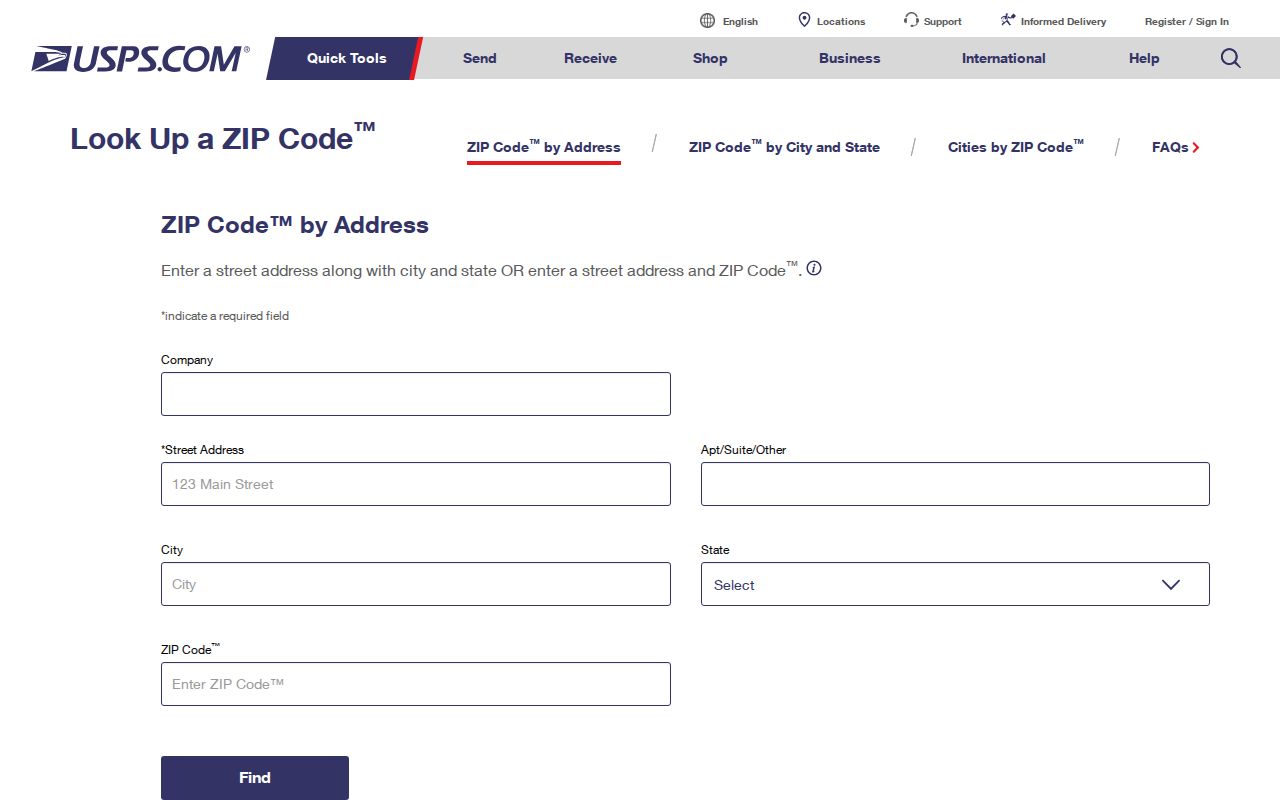
That two-source check is especially useful for 80212, 80235, 80470, and the other crossings documented in the county table.
Finding Records Inside One ZIP Code
A ZIP code can narrow a Jefferson County search, but each local system accepts a different field and returns a different record set. The assessor can filter parcels and sales. GIS can show address, parcel, city, zoning, and tax context. The county voter file is a dated request product, not a public bulk name search. USPS verifies delivery. Keep those roles separate.
- Verify the address. Run the full street address through USPS and save the returned postal city and ZIP. Note any crossing in the coverage table.
- Check the parcel route. Use the assessor address search with the ZIP, city, and street fields, then record the parcel or PIN and the mailing versus situs address.
- Inspect county geography. Open the GIS or jMap layers for parcel, address, municipal boundary, zoning, and tax context. The research found no general ZIP-wide resident search in GIS.
- Use voter channels correctly. GoVoteColorado handles a person's own registration and update. A monthly Jeffco file request is free, excludes confidential voters, and has its own published fields.
- Narrow the next request. Once a ZIP points to a street or parcel, ask the custodian for the exact record and date range instead of treating the ZIP as an identity result.
After a ZIP is narrowed to a named street, the Jefferson County street directory route is the better place for the address-by-address record chain. A ZIP code directory should stop at the geography handoff.
Jefferson Assessor Filters for ZIP Searches
The county property portal exposes ZIP-capable modes, but the output is a parcel or sales set, not a resident roster. The address tab pairs a ZIP dropdown with city and street fields. The sales tab pairs ZIP with transaction and property filters. Use the result to find a parcel identifier and then inspect the record's field meaning.
| Portal mode | ZIP-capable field set | Returned context |
|---|---|---|
| Assessor Address | ZIP dropdown with city and street fields | Address result grid and parcel context. |
| Assessor Sales | ZIP, sale date, sale amount, city, market area, neighborhood, subdivision, acreage, year-built, and property type | Property and sales set, not a ZIP resident list. |
| Neighborhood, tax district, or tax authority | Parcel and tax geography fields; live field list varies by tab | Tax and geography context that needs current portal inspection. |
| Parcel follow-up | Address, parcel, reception number, or PIN/AIN | Use the identifier to move from postal geography to a county record. |
The Jefferson County assessor sales search is the source for the sales filter shown here.
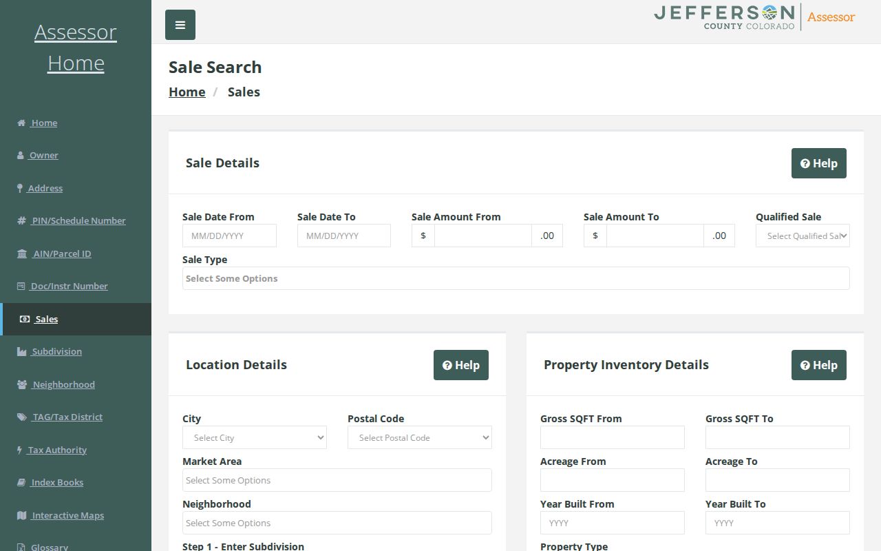
Read a mailing name as the field it is. It may identify an assessed owner or mailing contact, not the person who occupies the parcel.
County GIS Draws an Approximate ZIP Shape
Jefferson's GIS SNAP-by-ZIP service says USPS ZIPs are street-based and do not have true polygonal boundaries. The map polygons are approximations built from USPS ZIP Code by Address data and county quality control. Its POSTALCITYNAME field is the post-office city, so a map label cannot decide whether the physical address belongs to Jefferson, Denver, Adams, Boulder, Douglas, Park, or a municipality.
Use GIS for a parcel and boundary check. Search an address, parcel, or reception number, then turn on city boundary, parcel, address, zoning, and tax layers as needed. The service can help explain why a postal city looks out of place, but the research found no general ZIP-wide resident search in the GIS layer. A ZIP code directory can describe the crossing; it should not convert an approximate map shape into a person list.
The Jefferson County ZIP and county-boundary GIS layer documents the approximate postal geography.
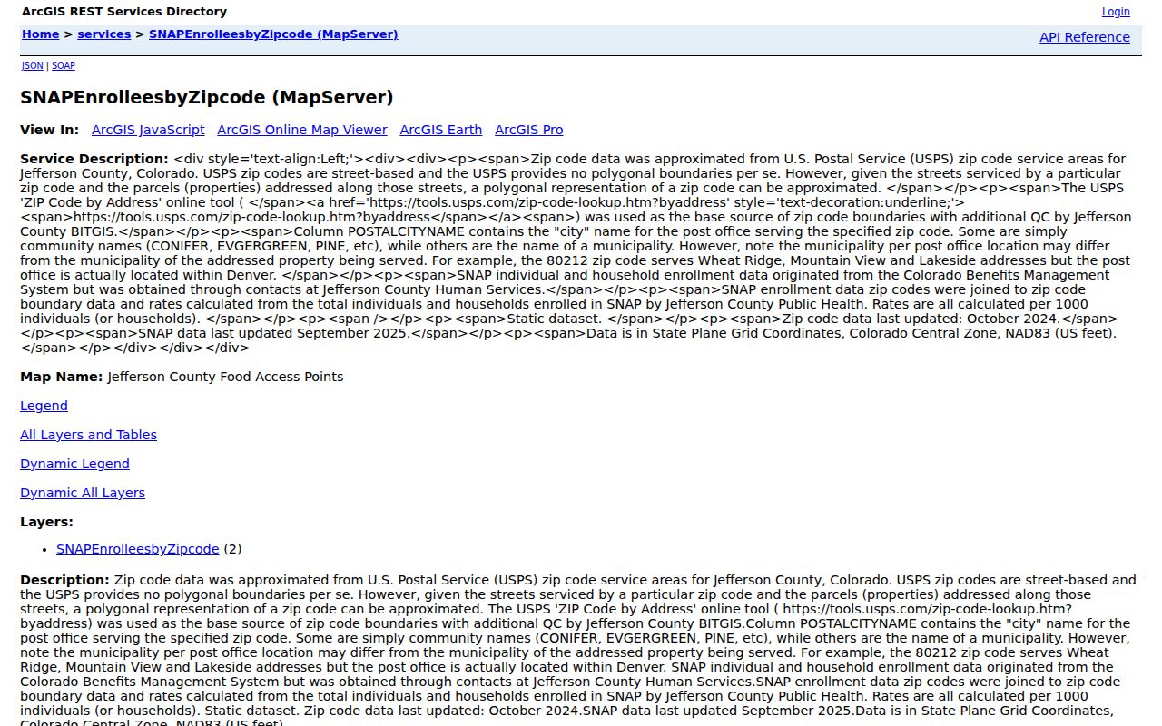
For an official export or historic address layer, the county lists GIS support at 303-271-8887 and accepts a focused written records request that names the layer, date, and address.
Census Context Is Not a Resident Roll
Census QuickFacts gives scale and geography, not names. The research records 582,910 Jefferson County residents in the 2020 Census, an estimated 578,533 in 2024, and an estimated 580,451 in 2025. Those figures help explain why a county can contain dense Arvada, Wheat Ridge, Lakewood, Edgewater, and Golden areas alongside Evergreen, Conifer, Indian Hills, Idledale, Kittredge, Morrison, Pine, and Buffalo Creek. They do not identify a person at a ZIP or address.
Use Census and TIGER geography for context around a ZIP, city, or county line. Use the assessor for a parcel question, USPS for delivery, GIS for local layers, and the voter or court custodian for a dated record with its own access rule. Mixing a population estimate with a name search creates a false sense of precision, especially in ZIPs the county table marks with unavailable statistics.
The Census QuickFacts profile for Jefferson County, Colorado is useful background for the county's scale.
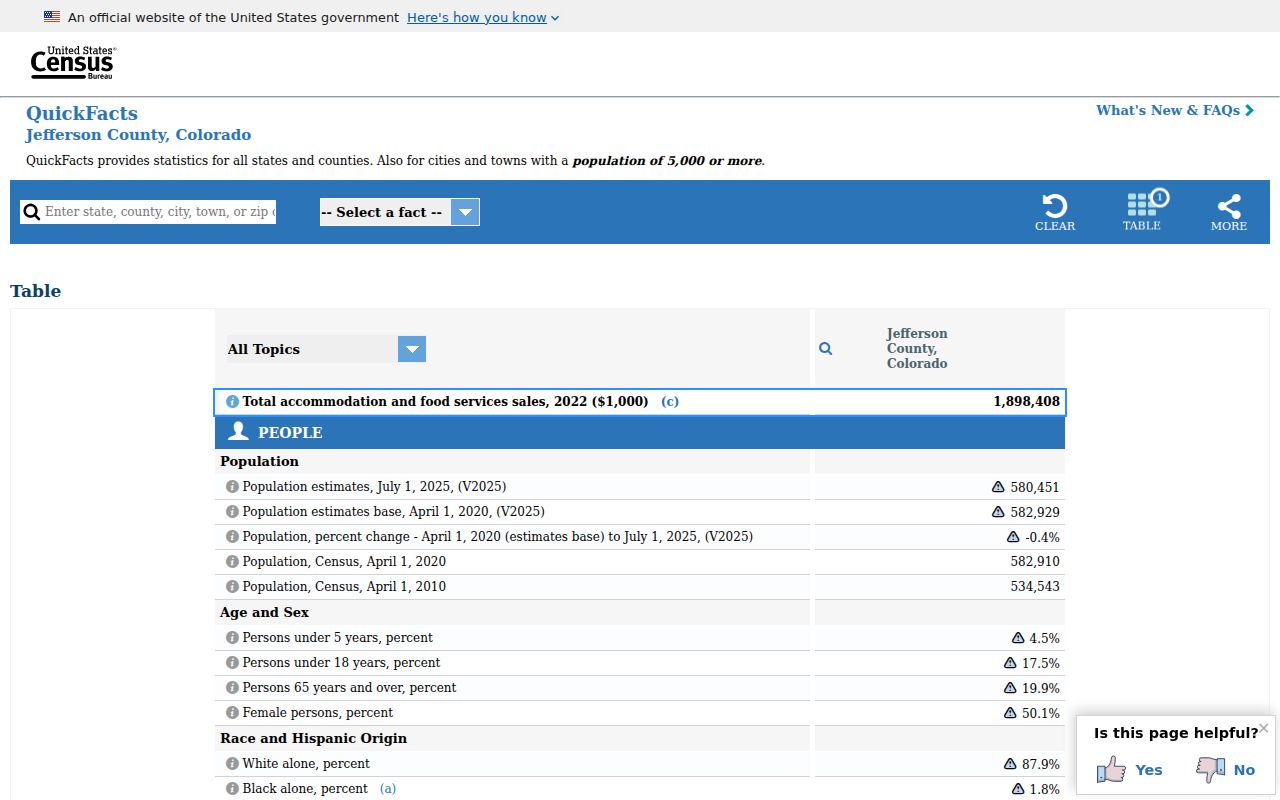
Per-ZIP population or registration totals should be dated and tied to the source's geography. The county's official table, not a broad estimate, remains the coverage reference for this directory.
Mountain ZIPs Need a Wider Search
Jefferson County's mountain ZIPs have a different research texture from its metro edge. 80425 points to Buffalo Creek, 80433 to Conifer, 80437 and 80439 to Evergreen, 80453 to Idledale, 80454 to Indian Hills, 80457 to Kittredge, 80465 to Morrison, and 80470 to Pine across Jefferson and Park. The food-system report notes travel outside some ZIPs for services and marks some areas with no food-access or production points. Those notes describe the source's service geography, not the presence or absence of residents.
Older records can carry still older place names. A 1859-1874 entry may say Golden City, Golden Gate, a mining district, a rural route, or a post office rather than the modern ZIP. A street can be renamed, renumbered, widened, or absorbed into a subdivision. For a family or place question, compare the directory edition, historic plat, county GIS address layer, deed legal description, newspaper, and map. Keep the old spelling beside the modern one instead of normalizing it away.
This is where a ZIP code directory hands off to historical research. The postal code narrows the search, but the dated locality and exact record type do the work.
Jefferson County ZIP Code Terms
Postal fields look alike but answer different questions. These definitions keep a ZIP search from being mistaken for a parcel, city, or person search.
- ZIP and ZIP+4
- A ZIP identifies a delivery area. ZIP+4 adds four digits for a more specific delivery segment, but it still does not identify a resident or establish a municipal line.
- PO-box ZIP
- A ZIP assigned to post-office box delivery. It may not describe the location of a street address, so use the supplied physical address when checking jurisdiction.
- Unique ZIP
- A ZIP assigned to one organization, facility, or special delivery destination. Its postal label should not be read as a neighborhood boundary.
- Carrier route
- A delivery route used to organize mail service within a ZIP. It is a postal operations field, not a county parcel layer.
The county's postal-city field and approximate GIS polygons reinforce the same rule: verify the street address and legal jurisdiction before using a ZIP result.
Offline ZIP and Address Fallbacks
When a portal cannot answer the question, the documented fallback chain is practical. USPS can check an ambiguous delivery assignment. County GIS can explain a boundary or provide a focused export request. The assessor's real-estate line is 303-271-8666, Planning and Zoning is 303-271-8700, and county GIS is 303-271-8887. Ask for the layer, date, address, and parcel context rather than a vague ZIP list.
A written CORA request can seek an official GIS export or historical address record from the county custodian. Libraries can provide historical directories, maps, and newspaper microfilm. Denver Public Library Western History, the Library of Congress, State Archives, and Jefferson County Archives supplement old street names and locality labels. For a current voter question, use the county clerk's official route; for a record held by another municipality or county, name that custodian instead of relying on a postal city.
The safest workflow is simple: use a ZIP to narrow, verify the address, inspect the parcel and boundary, and then request the record from the office with jurisdiction. Keep the access date because Jefferson's digitization and official map layers can change.